Opening Statement: GhostRide encourages you to go farther faster, more frequently.
Gantt Chart: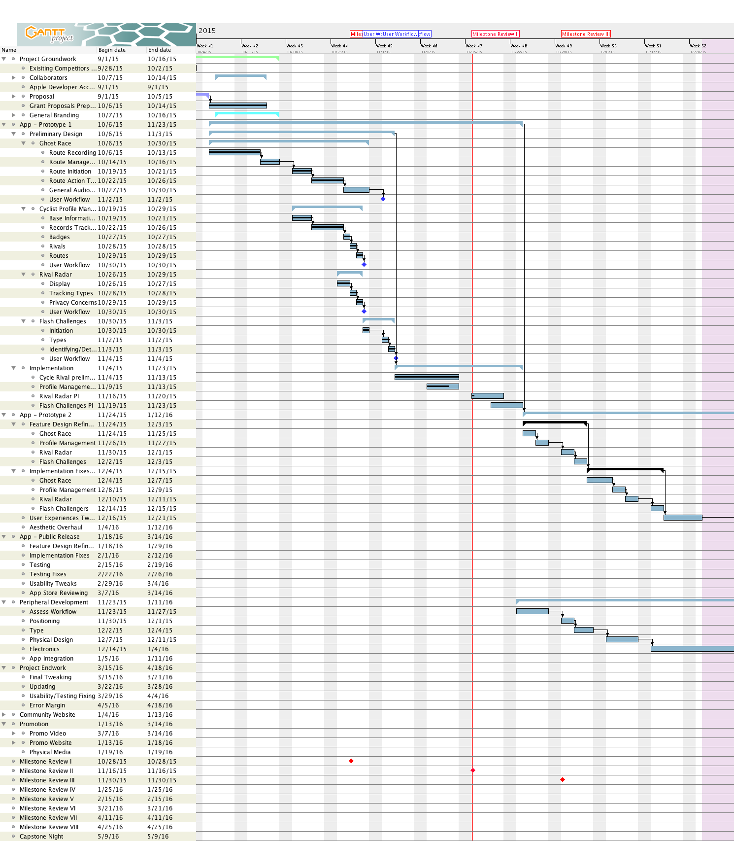
Summary of Gantt Chart tasks:
Essentially, simple implementations base features of application. Mainly focused on the GhostRide feature and underlying data structures/storage/retrieval process.
Progress:
- Created proof of concept prototype in xcode.
- Connected app to backend mysql database using post requests.
- Created PHP files to allow for data to be passed from the app, stored and retrieved.
- Set up recording for GPS data from app.
- Set up rough data schema for storing the GPS data points.
- Integrated MapBox into the application.
- MapBox to draw active route lines.
- MapBox map tracks user.
- MapBox map shows moving annotation of ride records played back in real time.
- Distance from recorded route is calculated (this is more complicated that it seems)
- Must find closest point on recorded path to user
- calculate that distance
- Traverse the points in the path to the location of the recorded rider.
- Add those Distances together.
- In reality this is actually somewhat precomputed. On route retrieval the distance elapsed between times is calculated for each discrete point. The current recorded playback point’s precomputed elapsed distance has the nearest route point of the user’s precomputed distance +closest point on route distance subtracted from it. This gives a realtime distance in meters.