MIT Place Pulse
Quantitative Data on Urban Perceptions
Place Pulse is an project that seeks to use people’s perceptions to gauge the larger relative perceptions of cities, by offering opinions of different photos. Users can select from a number of different questions all which ask “Which place looks…” followed by different qualifiers like “livelier”, “safer”, “wealthier” or even “more depressing”. It means to use the urban-perception data to open avenues of research that might not be previous considered, and to also examine correlation between factors such as crime rates and a city’s urban perception.
Place Pulse mainly uses two many-to-many new media solutions by crowdsourcing the data collection (via their website, in which you can take part) and aggregating, automating and visualizing the collected data in a number of different ways, including interactive rankings and a map system that is in progress.
This is definitely an interesting project because there are few sources of data on people’s perception of public space and the way that it might affect the way people act in a given area. It also provides a tool for finding places that might be particularly bad but unknown and making their plight visible.
San Francisco Garden Registry
Decentralizing Food Production in Urban Environments & Connecting People
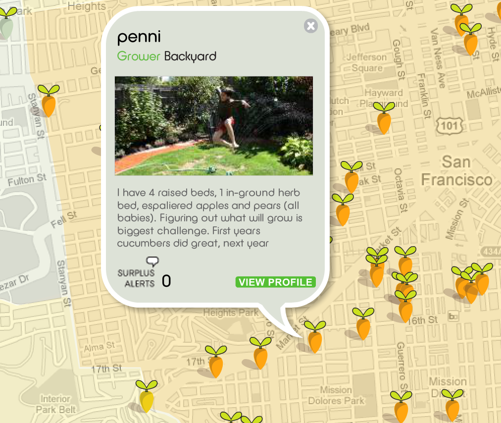 The Garden Registry is a tool that shows areas in San Francisco that can or are being gardened as a means of food production. It aggregates the data to create a land use map, connect individuals, and find new areas that could be, but are not currently, used for food production by means of urban gardening. By connecting people it serves as a social networking platform for people to trade surplus goods and plants, share information and build a more robust local gardening community.
The Garden Registry uses a variety of new media many-to-many solutions including crowdsourcing, aggregating and visualizing data, mobilizing people, DIY, sharing what is inaccessible and tapping into local networks. Crowdsourcing because people report their own gardens and possibly locations of suitable land, it visualizes that data into an easy to use website to create a land use map, it’s mobilizing the local community to create local food sources and use available areas efficiently, and finally its DIY. People bring it upon themselves to create these garden havens, and to connect with others to trade surplus goods.
This is a great idea because it effectively uses small urban areas that would otherwise go unused, and it connects people that wouldn’t normally be connected. It also serves as a tool to create more granular land use maps, most land use maps aren’t very detailed, while this tool, if used in a widespread fashion provides a very finely detailed picture of actual land use that would be unavailable using current methods.


